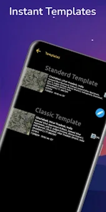
Comprehensive Geotagging with Gps Map Camera
Gps Map Camera is an innovative geotagging application designed for Android devices that allows users to capture photos and videos with precise location details. This app records essential information such as longitude, latitude, address, postal code, and time, making it particularly useful for professionals and adventurers alike. With features like customizable camera settings, templates for geo stamps, and filters, users can create unique visual records of their experiences.
Ideal for a wide range of users, including real estate agents, wildlife researchers, and travel enthusiasts, Gps Map Camera enables the organization of geotagged media within folders for easy access. The app allows customization of geo stamps, including location, date, and notes, enhancing the documentation of memories with relevant context. With its user-friendly interface and powerful functionalities, Gps Map Camera is an essential tool for anyone looking to enrich their photography with location data.